Increasingly, the transportation of people through cities has become a challenge. Cars, buses fill the roads, roads are delayed, air is foul due to all the exhaust. Time is wasted in traffic when it could be spent with the family or productive work. City officials are under a time constraint to resolve these issues without going over budget or causing disruption. This is where the optimisation of urban transport mobility is the key question of modern city planning.
The solution is that you need to consider the system as a whole. It's about considering walking, cycling, public transport, including buses and trains, and delivery vehicles as one integrated whole. In order to achieve a successful outcome, good data, clear goals, and measures must be used, the measures must be specific to the city, and they must be tailored to the city's specific characteristics. This guide takes the reader through the successful steps towards improving urban transport for everyone.
The Problem with Current Urban Transport
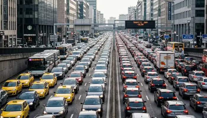
The car provided the base for many cities to be established. There was ample space for roads, parking lots and even public transport was but an afterthought. This had a number of issues:
Traffic jams are a time and fuel waster. Too Many Cars = Slow All Cars. Delivery trucks become stuck, emergency vehicles are delayed and commuters end up waiting hours in traffic.
Vehicle emissions are a source of air pollution which is detrimental for public health. Those with breathing issues, children and the elderly are particularly vulnerable. Polluted air affects the natural spaces and buildings too.
Those who don't drive are limited in mobility. Working, accessing health care and services can be a challenge for people with disabilities, low-income families, older citizens.
Loss of public space occurs when streets are planned primarily for the cars. Sidewalks get narrow, there are no bike lanes and squares become parking lots.
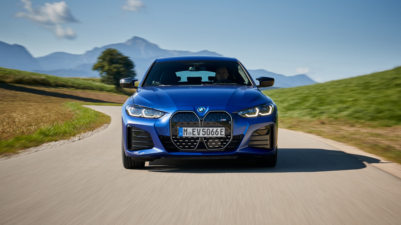
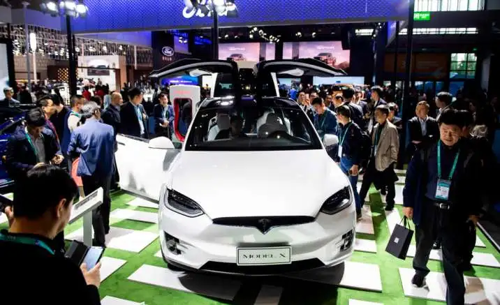
Read More: Mobility Electric Cars: Simple Travel for Everyday Life
The Foundation: Understanding SUMP Guidelines
A Sustainable Urban Mobility Plan, or SUMP, provides a clear path forward. These guidelines come from years of work by transport experts, city planners, and government bodies across Europe and beyond .
What Is a SUMP?
A SUMP is not just a transport plan. It is a strategic framework that puts people at the center of mobility planning. The approach considers all forms of transport, not just cars. It looks at walking, cycling, public transport, and freight movement as parts of one connected system .
The European Commission and other organizations have developed detailed SUMP guidelines that cities can follow. These guidelines break the planning process into clear steps .
The Four Phases of SUMP
Creating a SUMP follows a cycle with four main phases :
Phase 1: Preparation and Analysis
This phase sets the groundwork. It starts with assessing what a city already has. What is the current transport system like? What data is available? What are the main problems people face?
During this phase, planners build working structures. They bring together different departments, talk to stakeholders, and agree on timelines. They also look at existing plans and policies to avoid duplication .
Phase 2: Strategy Development
Here, the cities are making decisions on their own. This translates to developing a vision for mobility in the future. The vision may consist of objectives such as a "by X number of vehicles" reduction in car trips or a specified percentage increase in cycling. Planners make various scenarios to see how they can work.
Every scenario is a vision of the possible future based on alternate decisions. One scenario could be strongly based on the development of new tram corridors, for instance, while another may be based on the expansion of cycling and pedestrian space.
Phase 3: Measure Planning
Once a strategy is set, the real work of choosing measures begins. Measures are specific actions that bring the strategy to life. They can include building new bike paths, improving bus services, changing parking rules, or launching car-sharing programs.
Good measure planning groups actions into packages. This creates synergy where different measures support each other. For instance, adding bike parking at train stations works better when combined with secure bike routes leading to those stations .
Phase 4: Implementation and Monitoring
This phase is about putting plans into action and checking progress. Implementation involves managing projects, spending budgets, and coordinating with different agencies. Cities often start with smaller pilot projects before rolling out larger changes.
Monitoring tracks how things are going against the targets set earlier. This allows cities to adjust course if needed. If a measure is not working as expected, changes can be made .
Key Steps for Optimizing Transport Mobility
Following the SUMP structure helps cities stay organized. Here are the most important steps in plain language.
Step 1: Check What You Already Have
Before making changes, know where you stand. This means gathering data about current transport patterns. How do people travel? How many cars enter the city daily? What is the state of public transport? Which areas have poor access to services?
Readiness assessment is the first practical task. This involves reviewing the city's existing capacity and resources. Does the city have skilled staff? Is there political support for change? What funding is available? Skipping this step often leads to delays later .
Step 2: Set Clear Goals
Goals must be specific and realistic. Vague aims like "improve transport" are not helpful. Instead, use goals like:
-
Increase public transport use by 20% over five years
-
Reduce car trips to the city center by 15%
-
Add 50 kilometers of new bike lanes within three years
-
Cut emissions from transport by 30%
Goals should come from talking with the community. What do residents want? What do businesses need? Involving people early builds support for changes .
Step 3: Choose the Right Measures
Not every measure works in every city. Choose actions that fit local conditions. Important questions include: Does this measure match our goals? Can we afford it? Will people accept it? What is the timeline for implementation? Does it work well with other measures?
Scenario planning helps in this step. Cities create two to four different future scenarios that combine different measures. Each scenario is assessed for economic, technical, financial, and institutional feasibility. This comparison helps choose the best path forward .
Bundling measures is also important. Individual actions often work better when combined. For example, improving bus services works best when paired with better walking routes to bus stops and bike parking at stations .
Step 4: Monitor and Evaluate
After implementing measures, cities need to know if they are working. This is where monitoring comes in. Good monitoring answers two key questions :
-
Are we achieving what we planned?
-
What can we learn and improve?
Regular monitoring lets cities adapt and improve. If a measure is not delivering expected results, adjustments can be made. If something is working well, it can be expanded .
Step 5: Review and Learn
At the end of each planning cycle, conduct a review. This looks at what worked, what didn't, and why. Findings should be shared with stakeholders and the public. This builds accountability and trust .
Sustainable Urban Mobility Indicators
Indicators are tools that measure progress. They help cities track whether they are moving in the right direction .
Types of Indicators
There are three main levels of indicators :
- Output indicators measure direct results of actions. These are things that have been built or produced. Examples include kilometers of new bike lanes built, number of new bus stops added, or count of traffic calming measures installed.
- Result indicators measure changes that happen because of outputs. These show how outputs affect behavior and access. Examples include changes in cycling numbers, public transport ridership, or average travel times.
- Impact indicators measure long-term societal benefits. These are the ultimate goals. Examples include reductions in greenhouse gas emissions, improved air quality, fewer traffic accidents, or better public health.
You May Also Read: The Future of Smart Mobility 2025: Trends, Technology, and Innovation
Selecting Relevant Indicators
Choosing the right indicators matters. The SUMPs for BSR project has developed tools to help cities select indicators. These tools consider several factors :
- City size affects what indicators are relevant. Very small cities have different needs than large metropolitan areas.
- Policy themes should be balanced. Cities should track indicators across accessibility, safety, health, environment, economy, and governance.
- Data collection effort must be realistic. Easy indicators use existing data. Hard ones require new surveys or technology.
- EU alignment ensures indicators match broader regional goals. This matters for cities seeking funding or following regional requirements.
Using Indicators Effectively
Starting small is often best. Cities should begin with a core set of indicators that can be measured consistently. Over time, the set can be expanded as systems improve.
- Baselines must be established first. This means measuring the starting point before implementing measures. Without a baseline, it is impossible to measure progress.
- Targets should be set for each indicator. Targets give a clear picture of success. For example, reduce car trips by 15% within three years.
- Data ownership must be clear. For each indicator, assign a person or department responsible for data collection and quality assurance .
The Sustainable and Smart Mobility Strategy
The European Union has created a Sustainable and Smart Mobility Strategy. This is a broad framework that supports national and local efforts. It connects transport policy with climate goals and economic development .
Core Objectives
The strategy has three main pillars :
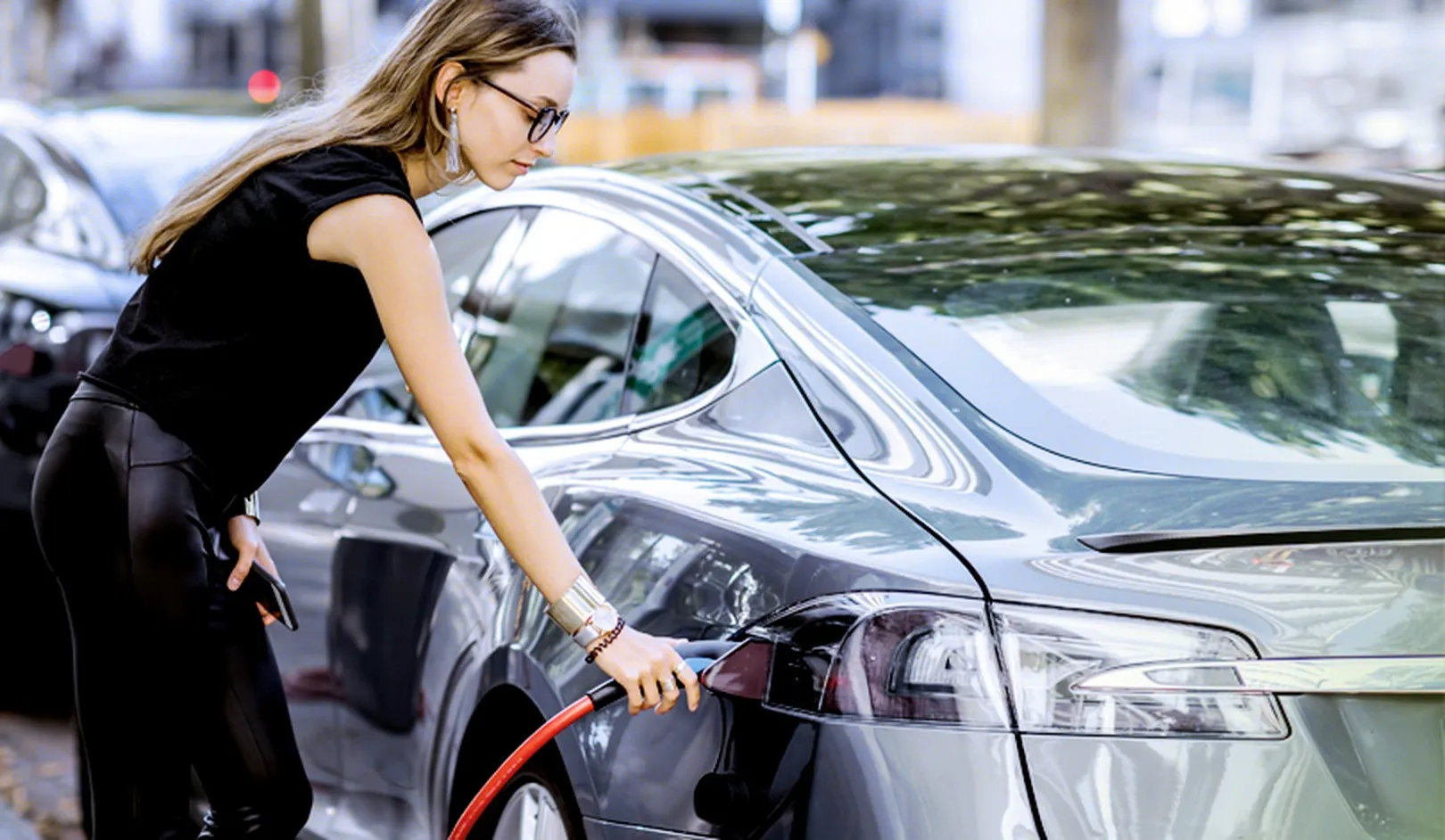
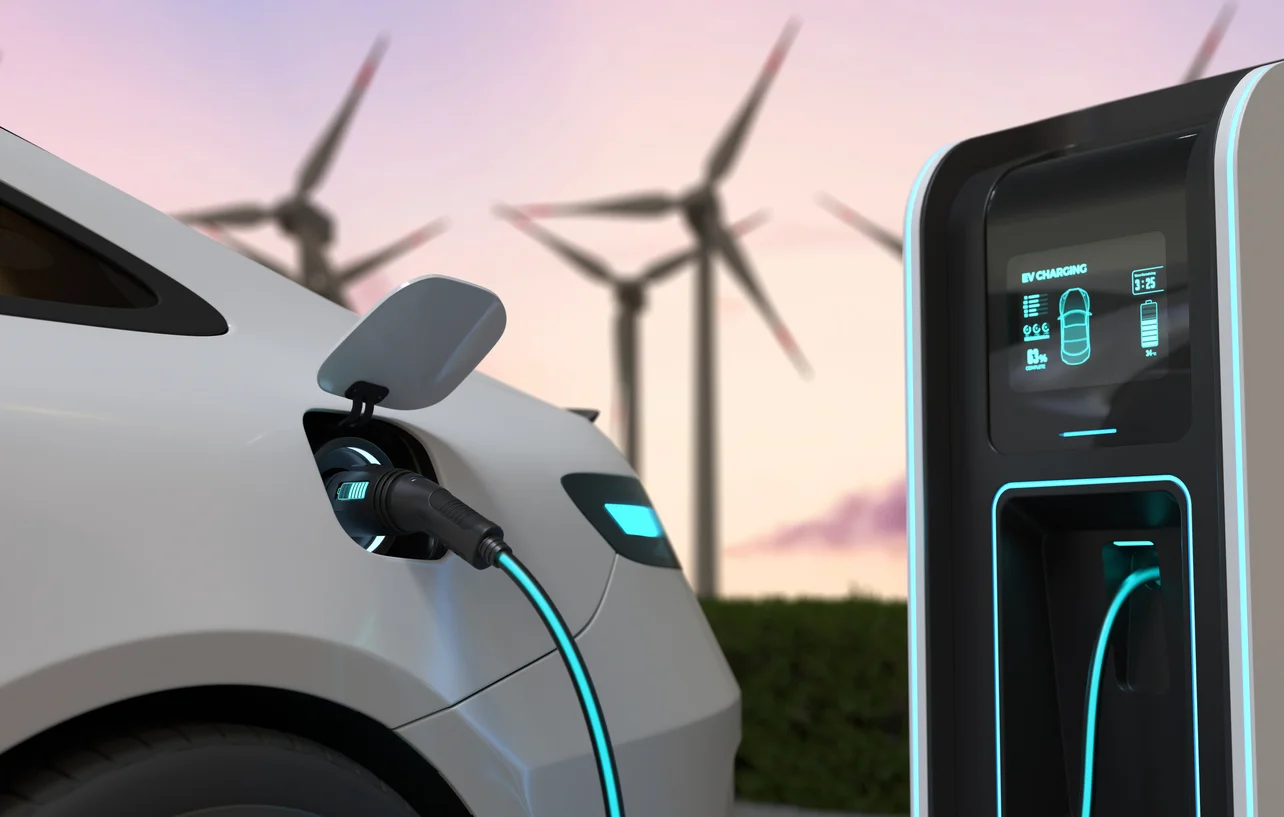
- Sustainability means moving toward zero-emission transport. This includes promoting electric vehicles, low-emission zones, and modal shift to cleaner transport.
- Smartness means using digital technologies to improve transport. This includes real-time information systems, smart traffic management, and integrated ticketing platforms.
- Resilience means building transport systems that can handle shocks. This includes diversifying supply chains, improving emergency planning, and reducing dependencies.
Multi-Level Governance
Success depends on cooperation between different levels of government . The Urban Agenda for the EU has shown how cities, regions, and national governments can work together effectively.
- Horizontal cooperation means different departments within the same level working together. Transport planning must connect with urban planning, environmental policy, and economic development.
- Vertical cooperation means different levels of government aligning their efforts. National policies should support local plans. Regional authorities should coordinate with city governments on regional networks like rail lines.
Practical Measures for Improving Urban Mobility
Active Mobility
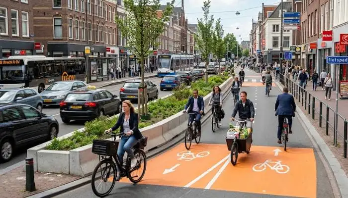
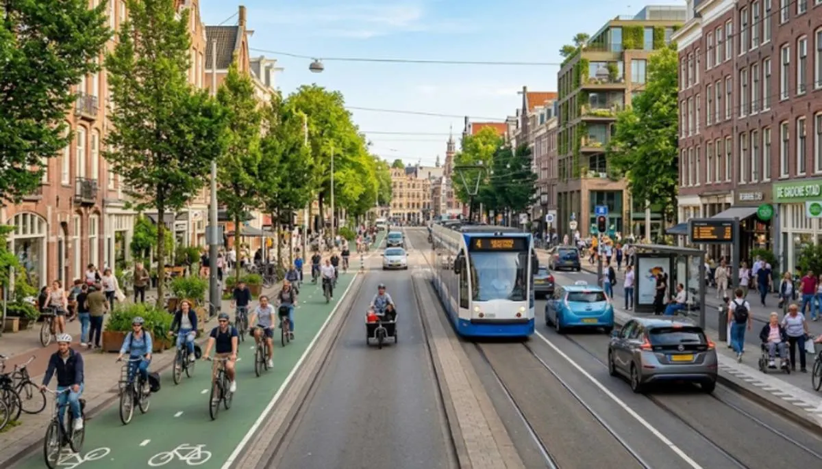
Walking and cycling are the cleanest and healthiest modes. Making them safer and more attractive is fundamental.
- Pedestrian improvements include wider sidewalks, better crossings, and traffic calming. Cities that prioritize pedestrians see benefits in safety, local business, and community life.
- Cycle networks need to be coherent and direct. Good networks connect key destinations like train stations, city centers, hospitals, and schools. Design principles include safety, comfort, and attractiveness .
- School streets are temporary closures of roads near schools. This makes it safer for children to walk or cycle, reducing car trips during peak times .
Public Transport
Public transport must be reliable, frequent, and accessible to compete with cars.
- Bus Rapid Transit can provide high-quality service at lower cost than rail systems. For smaller cities, scaled-down BRT can still offer significant improvements . Key elements include dedicated bus lanes, priority at traffic signals, and comfortable stations.
- Integration between modes is essential. This means synchronizing bus and train timetables. Providing secure bike parking at stations. Connecting shared mobility options with public transport stops. The goal is seamless journeys that are easy to make .
- First and last mile solutions help people get to and from public transport stops. Shared bikes and e-scooters can extend the reach of transit stops. Offering these options at stops increases ridership and reduces car dependency .
Parking Management
Managing parking is a powerful tool for reducing car use.
- Differentiated pricing encourages short stays and discourages all-day parking. Higher rates in central areas make driving less attractive for commuters .
- Parking hubs on the outskirts of cities allow people to park and switch to public transport. This reduces cars entering central areas.
- Reclaiming public space from parking creates room for people. Converting parking spots to bike lanes, pedestrian zones, or green spaces improves quality of life .
Digital Tools
Technology can make transport smarter and easier to use.
- Mobility apps provide real-time information on routes, schedules, and disruptions. People make better choices when they have good information.
- Smart traffic management uses sensors and data to optimize traffic lights. This reduces idling and improves flow for all users, not just cars.
- Digital maps help cities identify gaps in walking and cycling networks. Walkability indices can guide investment in pedestrian improvements .
Overcoming Common Challenges
Limited Budget
Cities often face tight budgets. Starting with low-cost interventions can help build support and gather evidence. Temporary bike lanes and pilot projects test what works without major investment. Once evidence shows success, funding larger projects becomes easier.
Cities can also combine budgets from different sources. Mobility, climate, and green infrastructure budgets all contribute to transport improvements. European benchmarks suggest spending of eight to thirty euros per person annually on active mobility to achieve significant results .
Political Opposition
Change is hard. People resist losing parking spaces or having roads changed. Strong community engagement helps build understanding. Using surveys, forums, and neighborhood committees gives people a voice.
Reframing the conversation also helps. Instead of "closing streets to cars," talk about "opening places for people." Focus on benefits like safety, cleaner air, and stronger local economies .
Fragmented Governance
Many cities have fragmented responsibility for transport. Different agencies handle roads, public transport, parking, and planning. This fragmentation makes coordination difficult .
Formal coordination structures help solve this. Regular meetings between departments. Shared responsibilities for transport projects. Clear processes for decision-making .
Conclusion
Optimizing urban transport mobility is not about quick fixes. It is a long-term process that requires careful planning, strong community engagement, and consistent monitoring. The SUMP approach provides a proven framework. Sustainable mobility indicators help track progress. The EU strategy provides a broader policy context.
Cities that follow these principles can achieve real improvements. They can reduce traffic, cut pollution, and make their streets more livable. They can give people more choices for how to get around. And they can build transport systems that work for everyone, not just drivers.
The key is to start small, learn from experience, and keep improving. With the right approach, every city can become more accessible, healthier, and more sustainable.
FAQs
What is meant by SUMP and why is it important?
SUMP (Sustainable Urban Mobility Plan) is a plan that is people-oriented. It enables cities to shift their focus of design to focus on providing transport systems that operate for all rather than for cars. It's important because it provides cities with a clear step-by-step process to follow.
2. What are Sustainable Urban Mobility Indicators?
These are measuring devices that measure progress. They assist city action in monitoring whether the action is effective. These can include the number of new bike lanes, reduction in public transport use, and decreases in air pollution.
3. What are the first steps cities can take to create a better transport system, when they have limited funds?
Low cost pilot projects are an option for cities to begin with. The temporary bike lanes and trial pedestrian zones are a way to try out an idea without a lot of money. After these are successful, it will be easier to obtain financing for bigger projects.
4. How will the EU Sustainable and Smart Mobility Strategy benefit cities?
Offers a more general policy context. It links local plans of action to regional climate and economic outcomes. Also, it promotes intergovernmental cooperation.
5. What is the first step a City needs to take to optimise mobility?
The first thing to do is to see what the city already has in place. Obtain information about existing travel patterns. Evaluate the resources and political assistance available. Be aware of the starting point before making changes.